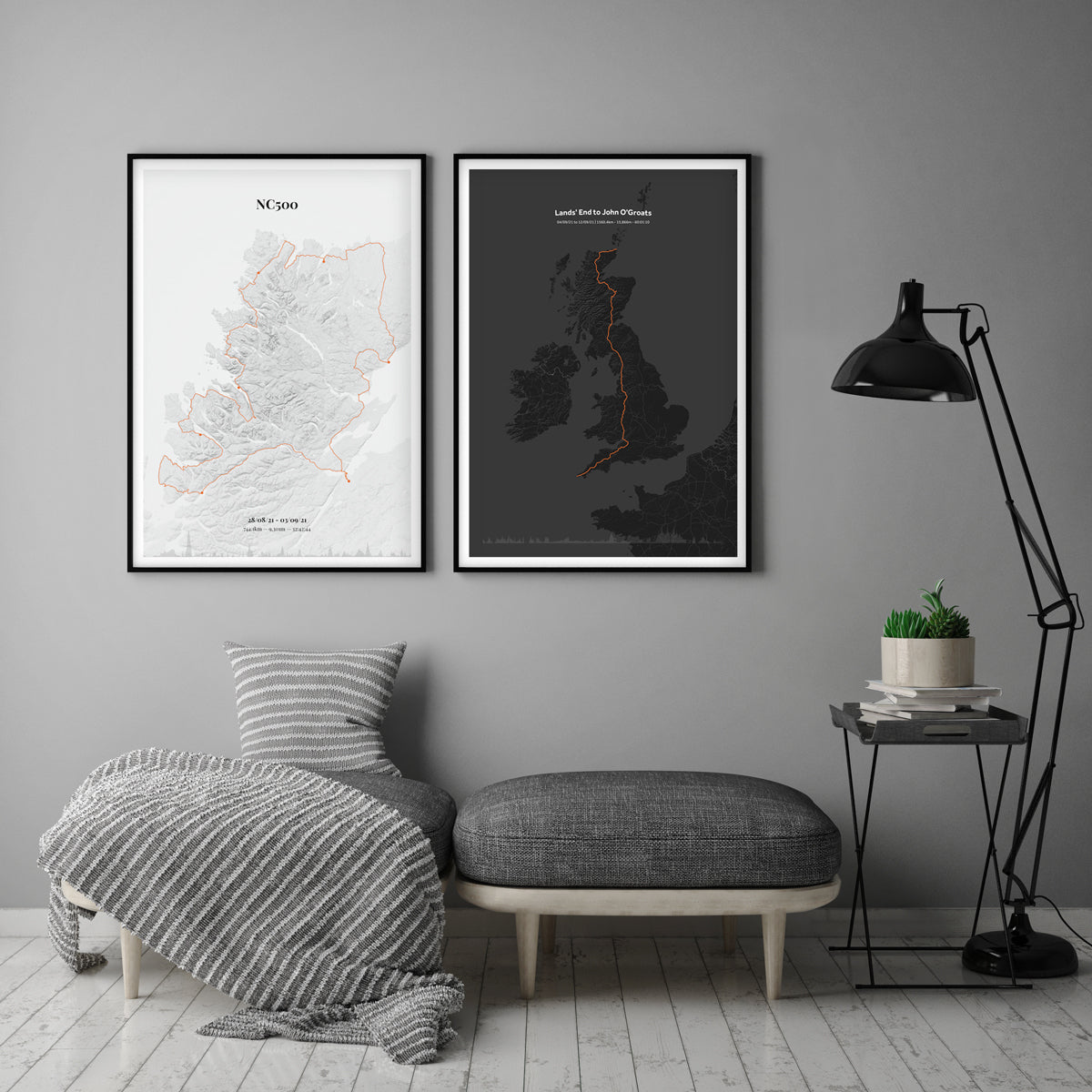
So at some point you did a ride that was tougher, more sentimental, or just better than your others. It might have been recently or it might have been a few years ago. For me it was doing LeJog, solo, without any real training. In April. An alcohol fuelled New Years conversation turned into a challenge… I’m still pretty proud of the fact I did it.. Well I didn’t find a good enough excuse not to do it! The highlight of my ride was riding 100 miles without any food (just breakfast) and 2 bottles of water. I left my wallet in the B&B in Bath and didn't figure it out until lunch time. Fun times.
We’ve just created a tool that lets you create an awesome print to remember those kinds of rides. So you, and I, can put something in the office / zwift cave to inspire the next one.
So how does it work
Step 1
You are going to need some form or ride data. Either a GPX or a Strava account with some physical rides (Zwift ones don't work). Below we have some notes/helpers for both options.
Strava
If the ride is from a while ago, or you do a lot of riding, you might struggle to find it on Strava as they limit the amount of rides we can pull from their system (about 150 I think). If your ride doesn't come up then download the GPX file and upload it to our tool that way instead.
If you are trying to make a map for a friend, or the download GPX button isn't showing for you, try using this Google Chrome extension: Strava GPX Downloader. Install it and grab that GPX from Strava.

GPX
If you already have a GPX (or many) then simply click the GPX button and upload. You can upload single files or multiple for multi-leg rides.

I don't have Strava data or a GPX...
If you are without data… The next best thing to do is recreate the ride in a tool like plotaroute and download the GPX from there. I helped someone recently recreate a trip from the southern tip of Argentina up into Mexico. It took some time but worked a treat.
Step 2
Go to the map maker and connect to Strava or upload your GPX file(s). The system works with multiple files if you have done something like LeJog. For Strava rides authorise the connection, wait a few moments while we grab your data, run a search for your rides and keep clicking the + button until you are done.
If you upload multiple rides check and adjust the order when they are uploaded (drag and drop). You want day 1 at the top. This is important if you want to show the profiles in the correct order for each day.
Step 3
Have a play around in the design editor. It's best on a laptop/computer as you can see a bit more detail but works perfectly fine on mobile too.
Note: We pull as much data from the ride as possible but we can't get time data from GPXs so you will have to write that in yourself. If you are adding together multi-leg rides I suggest using an online time calculator to help.
Step 4
Complete the order and we will email you a larger preview via email within 1-2 working days (usually same day). We do this manually as I like to check each one before sending them out. Once we have your thumbs up we print them out on our photo quality Canon Pro-1000 and ship them out to you 1st class.
If you need any help, or just have questions, please drop us an email or chat to us on the chat thingy... If not. Go and make a map and let us know what you think :)